A Comprehensive Database of Flood Events in the Contiguous United States from 2002 to 2013
In this database, a comprehensive dataset consisting of more than half a million flood events automatically extracted from 6,301 USGS flow records and radar-rainfall fields (Stage IV) from 2002 to 2013, using the characteristic point method (CPM). The database features event duration; first- (mass center) and second- (spreading) order moments of both precipitation and flow; flow peak and percentile; event runoff coefficient; base flow; and information on the basin. It can support flood modeling, geomorphological and geophysical impact studies, and instantaneous unit hydrograph and risk analyses, among other investigations. The database can be downloaded here. Events are stored in ESRI shape files grouped according their USGS gauge location in folders named by the 4-digit HUC code.
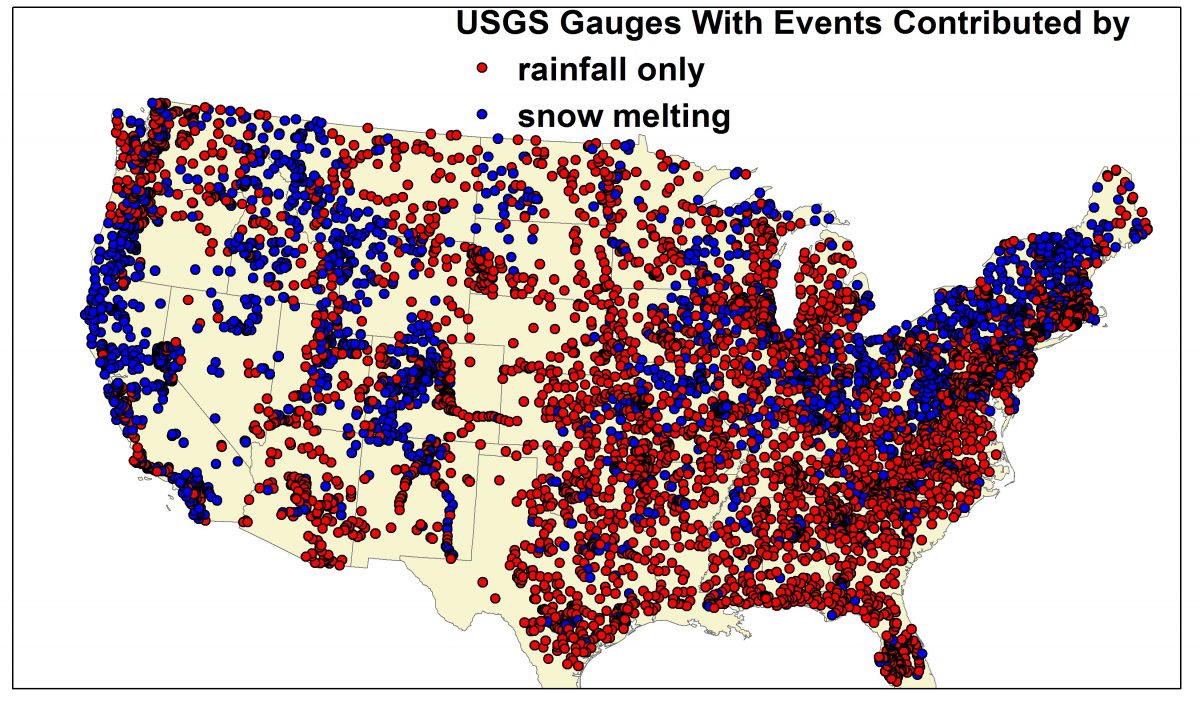 Figure 1. Included USGS flow gauge with blue ones containing flood events contributed by snowmelt.
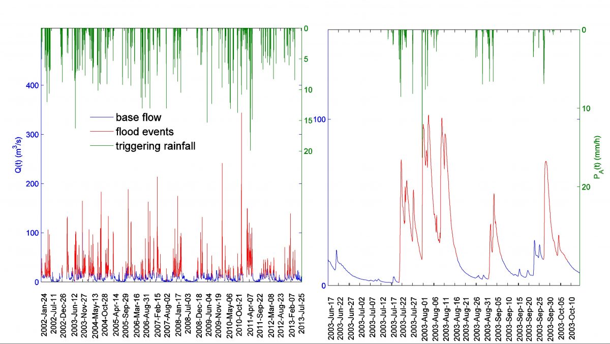
Figure 2. An example of extracted flood events (at gauge USGS03007800) and the triggering precipitation, PA(t).
Descriptors of a flood event record. “yyyy” stands for 4 digits of the year, mmm stands for three-letter abbreviation of the month, “dd” stands for 2 digits of the day and “hh” stands for the two digits hour.

E<·>, Var<·>, and Cov<·,·> stand for the expectation, variance, and covariance, respectively, of a random variable or variables. Variables TQ, TR, and LS denote the flow concentration time, runoff generation time, and travel distance, respectively. Variables used in TABLE 1 are described as following: p(t,A’), represents the precipitation field with t denoting the time and A’ denoting the location. A, and tlag stand for drainage area and time lag between the start time of a flood event and the triggering precipitation. Variables and are the duration of a flood event and its triggering precipitation.
References
[1] Xinyi Shen, Yiwen Mei, and Emmanouil N. Anagnostou*, 2016 “A Comprehensive Database of Flood Events in the Contiguous United States from 2002 to 2013”, Bulletin of Bull. Am. Meteorol. Soc., (under minor revision).
[2] Mei, Y., and E. N. Anagnostou, 2015: A hydrograph separation method based on information from rainfall and runoff records. J Hydrol, 523, 636-649.